
SIMON NEVILLE PROJECTS


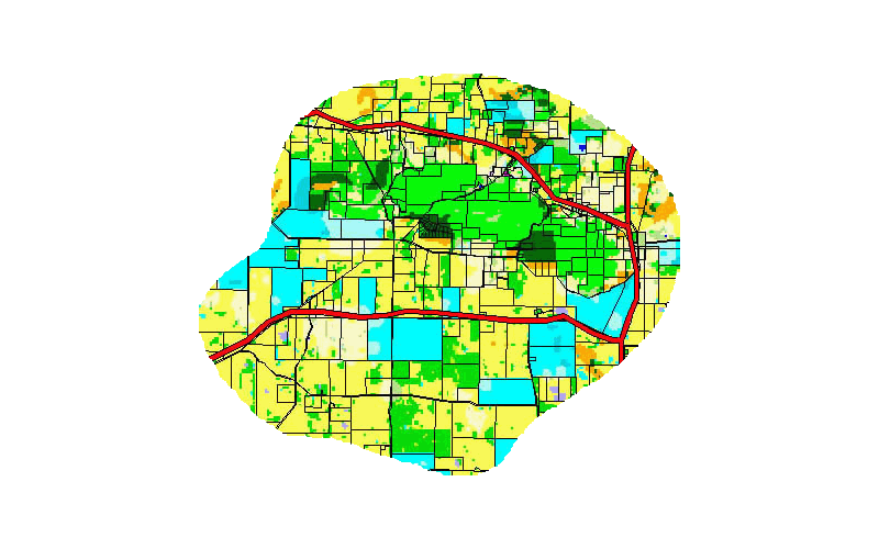
This project used MCAS-S (the Multi-Criteria Analysis Shell for Spatial Decision Support) to develop a tool that will identify priority locations for investment in NRM projects in Western Australia.
The tool implements spatial multi-criteria identification of key sites, providing justifiable and objective support for project funding applications. This will enable targeting of future projects, and thus lead to better long-term outcomes than would be possible without such a tool.
Development involved a collaborative workshop process to identify suitable spatial criteria, a data acquisition stage, and the processing of a large set of spatial data into the MCAS-S format. A number of tool components have been produced; these can be modified as required by the tool user to suit specific needs and funding rounds.
Training was provided as part of our tender to ensure capacity was developed within the regional NRM organisations, and this capacity is being used both to integrate our results as well as in new projects.
Project Contact: Dr Dimity Boggs - Wheatbelt NRM
The NATURAL RESOURCE MANAGEMENT PLANNING TOOL
Natural Resource Management WA. 2024-25
"Simon, you’ve been a blessing. We couldn’t have engaged a better consultant on this job, you’ve been outstanding."
Dr Dimity Boggs - Project Manager


In association with Unearthed Environmental Services Pty Ltd.
A project to develop a model to identify priority locations for cost-effective, ecologically important revegetation efforts in the Fitzroy Basin. This model would allow the Fitzroy Basin Association (FBA) to target future revegetation projects.
The ranking process for priority locations considered many factors: relative need for revegetation for various benefits, including to restore ecological increase agricultural productivity and improving habitat connectivity in the landscape, as well as considering different methods for revegetation, planting, seeding, assisted regeneration etc, and the potential cost of revegetation works.
We used MCAS-S (the Multi-Criteria Analysis Shell for Spatial Decision Support) to develop and integrate specific models.
Training was provided as part of our tender to ensure capacity was developed within FBA, and this capacity is being used both to integrate our results as well as in new projects.
Project Contact: Ms Hannah Kaluzynski - Fitzroy Basin Association
A MODEL TO IDENTIFY PRIORITY LOCATIONS FOR INCREASING THE EXTENT OF NATIVE VEGETATION
Fitzroy Basin Association QLD. 2023-24


The overall objective of this project was to develop a Regional Environmental Prioritisation Tool through a stakeholder engagement process utilising MCAS-S.
In this project we completed three sub-objectives:
-
Developed a GIS based decision support tool using MCAS-S to create a Regional Environmental Prioritisation Tool
-
Carried out a stakeholder engagement process to ensure stakeholder alignment with the outputs and outcomes of the project.
-
Produced resources (maps and reports) to inform environmental project selection for Perth NRM.
We also provided training in MCAS-S, and understand that the results and the MCAS-S project are currently being used in project appraisal.
Project Contact: Mr Dan Friesen, Perth NRM.
COLLECTIVE VALUES: PRIORITISING ECOLOGICAL ASSETS IN THE SWAN NRM REGION
Perth NRM 2021-23


In association with Jonathan Schultz (BarraQDA Research Services)
This project reviewed critical aspects of fire management planning in South West WA. It was specifically aimed at providing accurate and quantified information about recent outcomes. We collated evidence about two contentious aspects of prescribed burning:
-
delayed responses to fires in the conservation estate;
-
increased burning over the last 4 years within the SW Forest Management plan area.
Outcomes from fire case studies were collated and used to develop a case for increased attention to rapid-response fire suppression capability in WA. The increased frequency of prescribed burns in the Forest Management Plan area of the conservation estate - in particular in conservation forests - was illustrated. examined.
Project Contact: Mr Keith Bradby, Gondwana Link Inc.
ANALYSING PRESCRIBED BURNING AND WILDFIRE MANAGEMENT IN SOUTH WEST WA
Koorabup Trust 2020-21


In this project we used MCAS-S (Multi-Criteria Analysis Shell) to allow us to regionally assess roadsides using the same assessment criteria that Main Roads would use on a one-off basis. The modelling was aimed at developing a Roadside Vegetation Management Strategy in the Great Southern for Main Roads WA. Project involved scoping, multiple workshops with stakeholders to establish appropriate criteria, and sourcing and processing of spatial datasets to set up the MCAS-S system, and output of maps at scales and sizes suitable for Main Roads Contractors.
The spatial assessment framework allowed us to map re-vegetation and weed management priorities along about 3200 km of roadside in the Great Southern region. We then combined these priorities in an Integrated Roadside Vegetation Management Strategy.
Project Contact: Ms Gemma Maling - Main Roads WA/Fulton Hogan
VEGETATION MANAGEMENT STRATEGY - Main Roads WA. 2016-18


BIODIVERSITY PRIORITISATION and BIOSEQUESTRATION MODELLING - South Coast NRM. 2014-15
We provided GIS support and modeling using MCAS-S - to South Coast NRM on their project “Biodiversity Prioritisation and Biosequestration Modelling and Analysis” under their Climate Change Project. The project involved multiple interactive workshops, a great deal of data management, and the development of the many models, including biodiversity value assessment, biosequestration planting priority mapping, regional linkage mapping, agricultural priority mapping and others.
Similar projects have been carried out for Perth Region NRM, South West Catchment Council and Northern Agricultural Catchment Council.
Project Contact: Ms Kaylene Parker, South Coast NRM


GROUNDWATER DEPENDENT ECOSYSTEMS GIS/MODELLING NCCARF. 2011-12
This was a large National Climate Change Adaptation Facility-funded research project, involving multiple research and government institutions. We provided GIS Support and Modeling of risk to Groundwater Dependent Ecosystems from climate-change induce groundwater level change, in the Gnangara and Blackwood regions of WA. Datasets were prepared and input into Netica (a Bayesian Analysis framework) and outputs were returned to and displayed in ArcGIS.
The process followed was written up as a technical appendix to the Groundwater-Dependent Ecosystems Project final report.
Project Contact: Dr Jane Chambers, Murdoch University
CLIMATE IMPACT MODELLING - South West Catchments Council. 2014
A large amount of climate modelling data was released during 2013-14, and South West Catchment Council required some simple assessment of the potential impacts of projected changes on the region. This project provided some clarity as the the most relevant modelling outputs, and carried out simple modelling to discuss Rainfall & temperature change over time in relation to SWCC biological assets (National parks etc.)
The project was carried out using a single CMIP4 model (CSIRO Mk3.5); and then revised as CMIP5 projections became available, using best and worst case models (MIROC5 and CanESM2).
A similar project was carried out for South Coast NRM.
Project Contact: Mr Mike Christensen, South West Catchments Council


.jpg)
.jpg)
CONTRACT MAPPING - Centre for Excellence in NRM, UWA. 2010
A contract position for Centre of Excellence in Natural Resource Management, UWA. Final maps were required for the Collie River Action Plan. Two map series were required to cover the entire river system, necessitating complex symbology and challenging annotation. We picked up a task that exceeded the capabilities of the project staff and provided high quality output in two map series.
Project Contact: Prof Peter Cook, CENRM

Katanning LCDC were faced with a common problem - they needed to consolidate large numbers of datasets showing project outcomes spanning many years of activity, with inconsistent, incomplete or even absent data tables. We developed simple tools in QGIS to efficiently attribute datasets, and consolidated hundreds of individual GIS files. We also developed training for KLCDC staff in the use of QGIS and the tools developed to improve their GIS capacity and allow them to internally manage their GIS data.
Project Contact: Ms Andrea Salmond, KLCDC
DATA MANAGEMENT - Katanning LCDC. 2015

The Whole Farm Nutrient Mapping project is run out of DPIRD in Albany, but has staff across the South-West of WA. They use a number of tools for managing and displaying the results of nutrient mapping exercises on farms. The project is moving from using databases and a lot of manual work to using QGIS for automated map production. DWER staff have now been trained to engage in this program.
We modified our QGIS training program to provide two customised 2-day training programs for their staff. These included custom exercises illustrating particular solutions to their work needs.
Project Contact: Mr David Weaver, DPIRD